

- /
- Katun Road The Great...
- /
- Mountains
Mountains

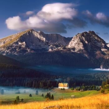
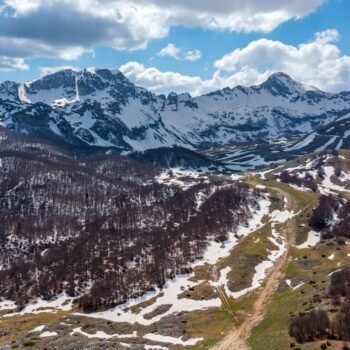
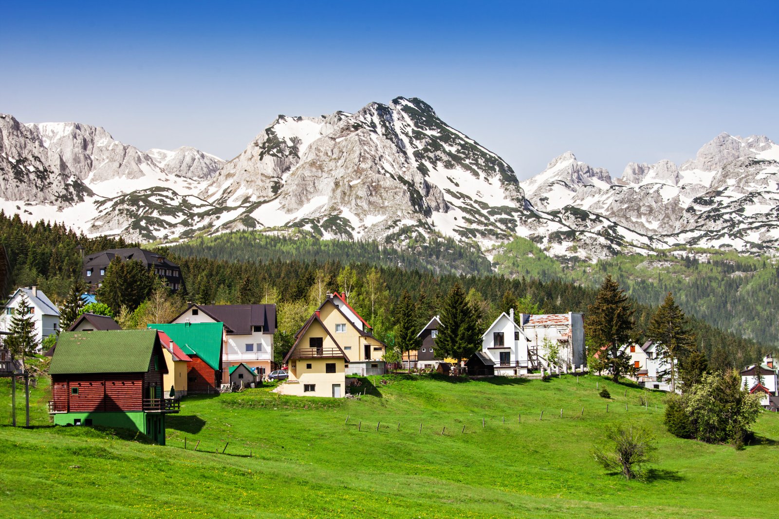
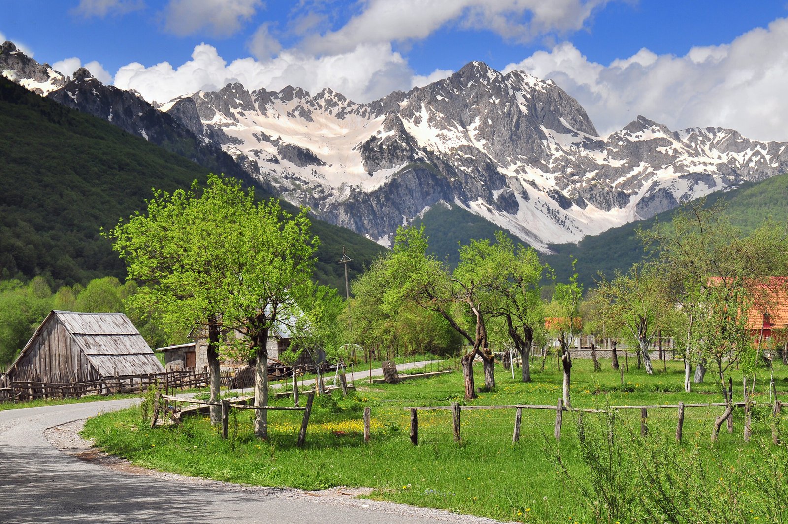
DURMITOR
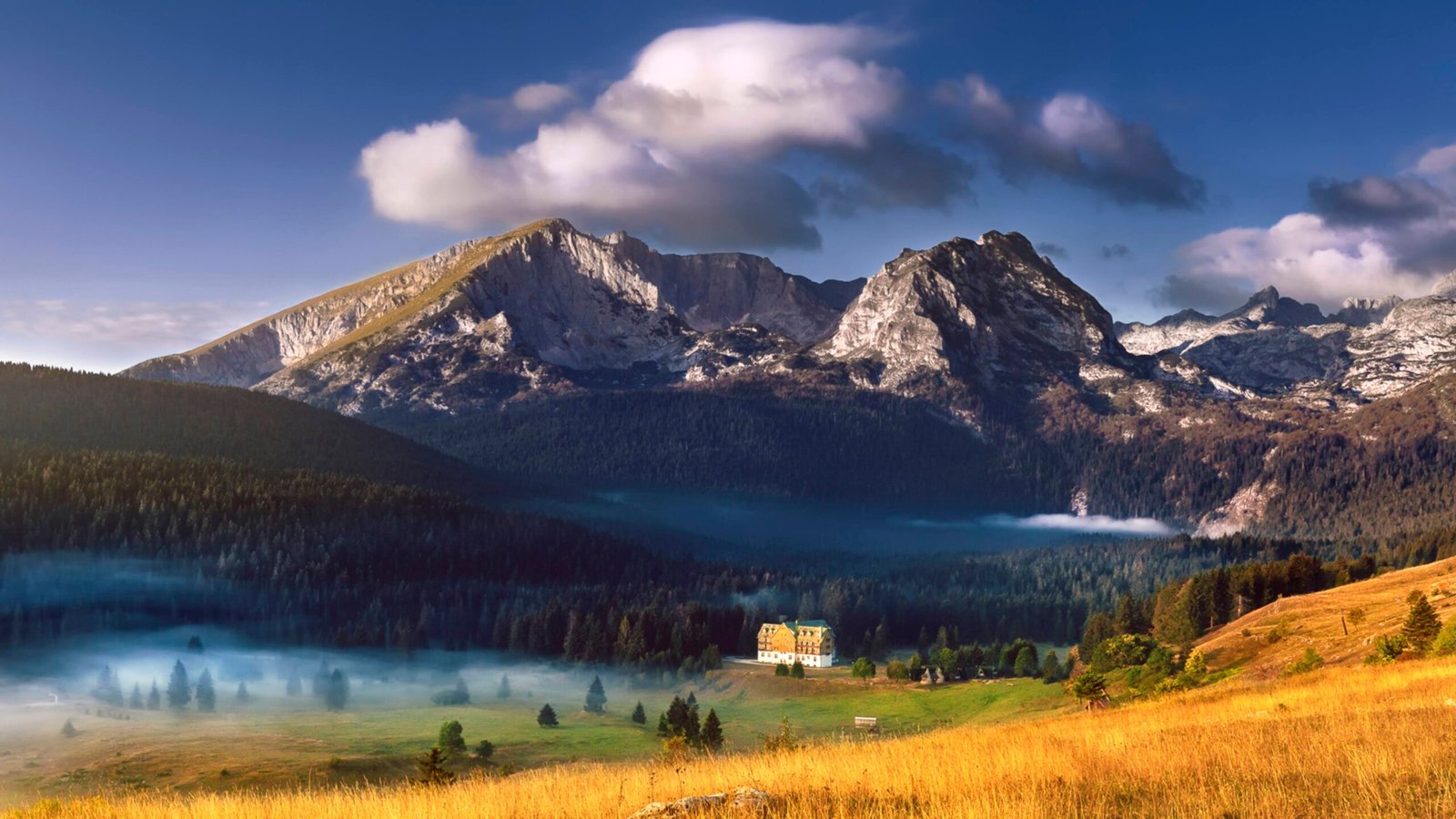
“Durmitor and the Tara Canyon are the scene of dramatic phenomena in both relief and time, and in the lives of the people who inhabit this world. In the peaks and on the slopes of Durmitor, as if paused for a moment, set in motion by primordial forces, the Earth’s crust belts are jumbled, tilting obliquely or perfectly upright, towering over each other, colliding, rising to the sky, plunging into the abyss, as if they will start again at any moment with a crash and roar, rippling the relief anew…
But the mountain and canyon are also full of calming beauty, tenderness, and love. Durmitor’s beauty embraces: even in winter when it’s covered in snow and ice, warmed by the sun to sparkle with crystal whiteness and a violet icy sheen. And in spring, when flowers scatter across the green meadows at its base, while its mass remains under snow; when vibrant greenery and patches of the last snow in shaded areas streak it. And in summer, when flowers of all colors adorn the meadows and rocky areas, when the meadows at the base grow into sheaves and stacks of mown grass, whose scent intoxicates and induces sleep, and blue and red blueberries and wild strawberries, swollen with sweetness, are scattered across the clearings. And in autumn, when dark forests blaze with the red and yellow colors of maple, dogwood, beech, and dog rose.” This was written by Mihailo Brajović in the book “Durmitor and Tara – World Natural Heritage.”
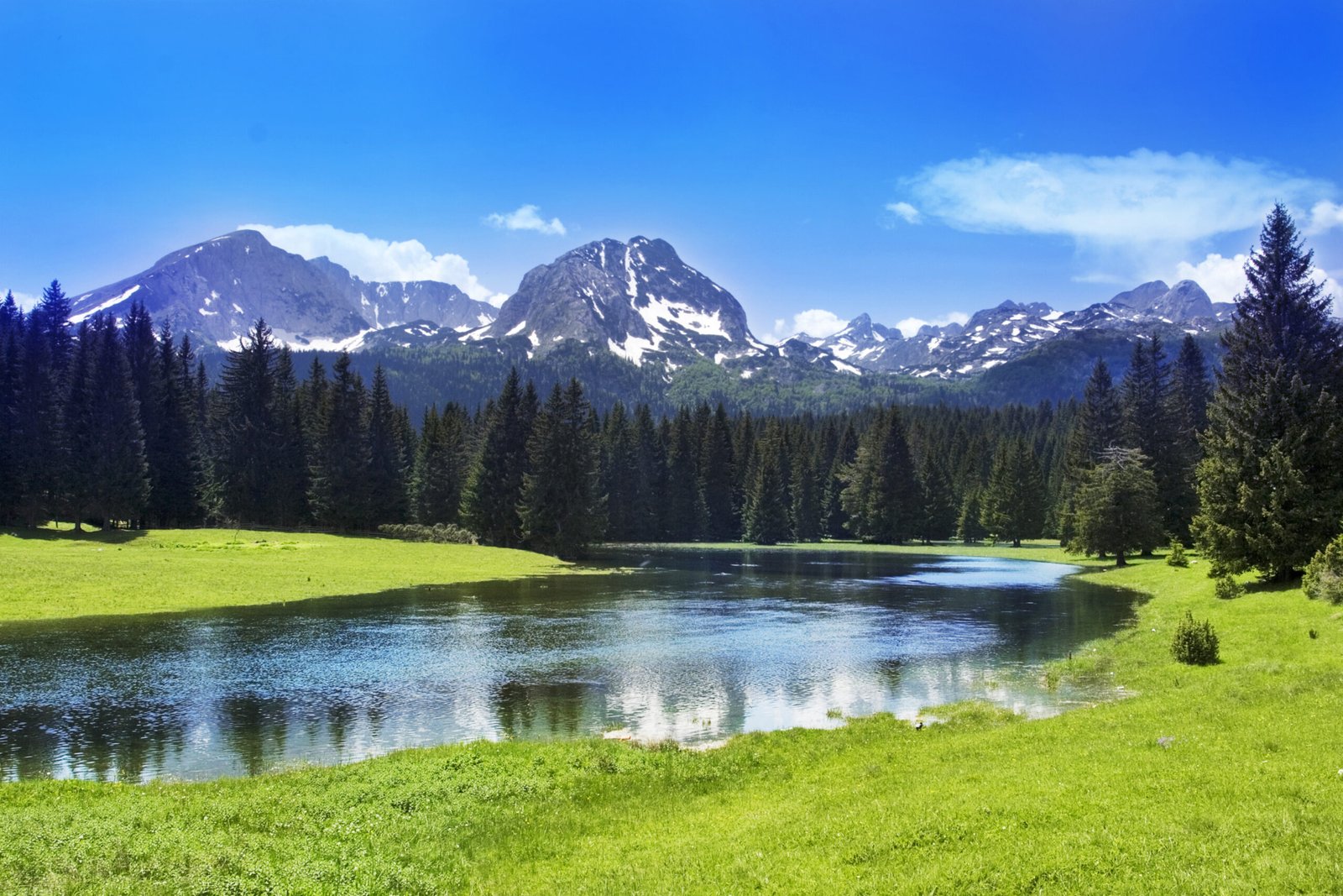
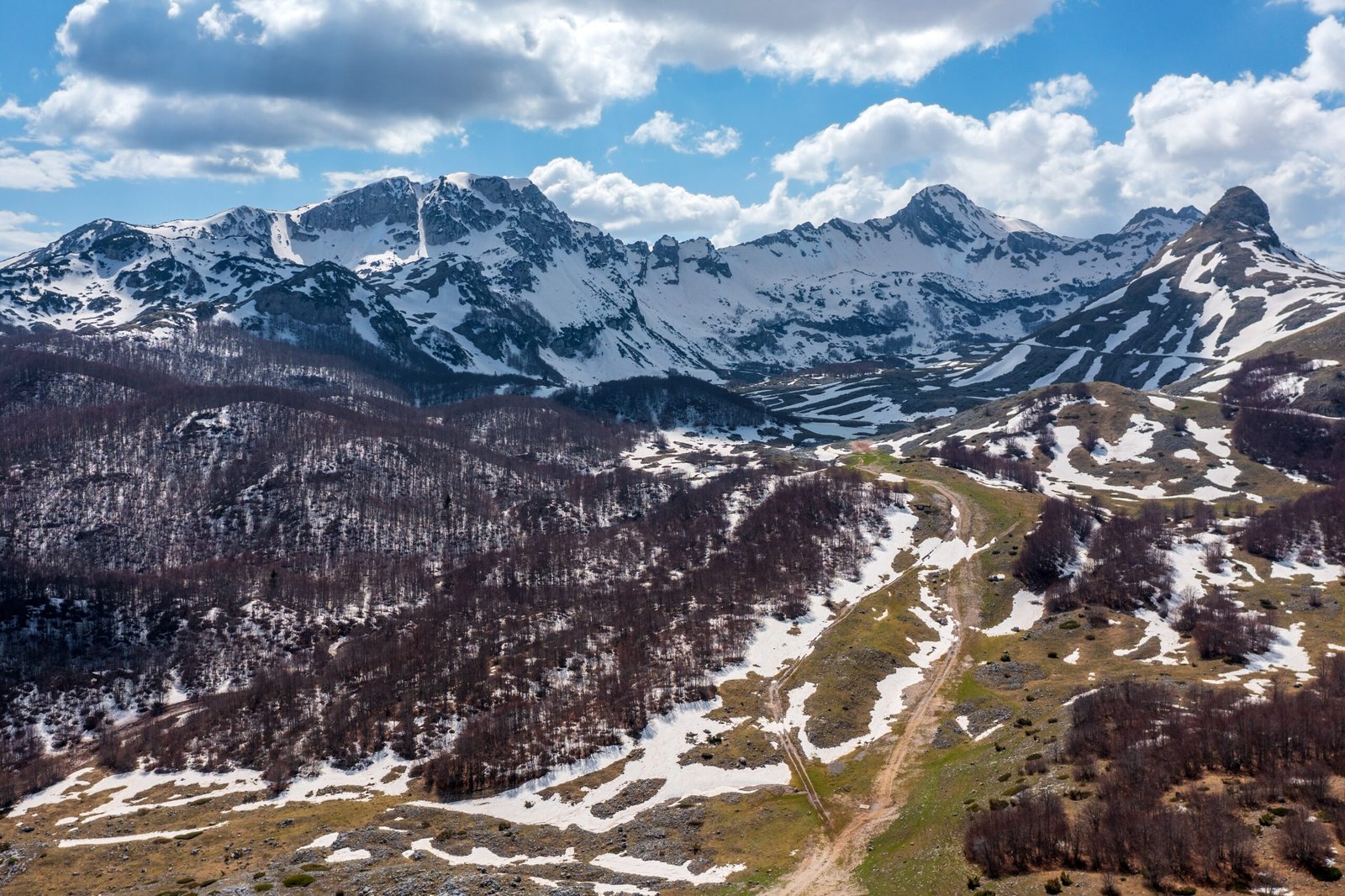
The Durmitor area consists of three geomorphological units: the Durmitor massif, Pivska Planina, and Jezera Drobnjačka (Jezerska Površ, Drobnjačka Površ).
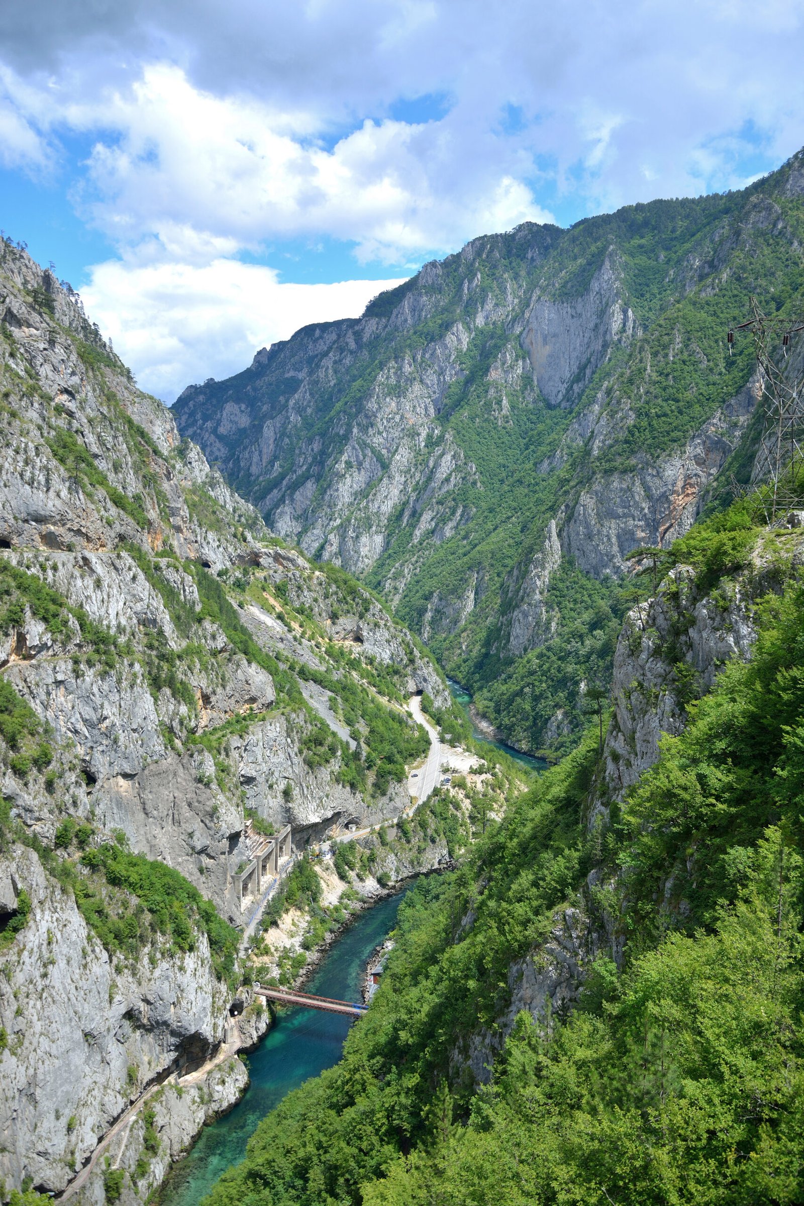
The wondrous frame of the Durmitor massif was drawn by mighty waters. To the north, its sides descend into the Tara Canyon (lowest point Nozdruć, 506 m), and to the south into the canyons of Bukovica and Komarnica. East of Durmitor is the Sinjajevina plateau, and it itself rests on the undulating surface of Jezera and Pivska Planina. In fact, it is a complex whole of mountain ranges, high peaks, deep valleys and canyons, vast forests, unusual lakes, caves, and pits. Everywhere are traces of long glacial work, erosion, accumulation, and crushing. Of a long time. It is about 55 kilometers long and about 20 km wide. The altitude difference is 2,000 meters.
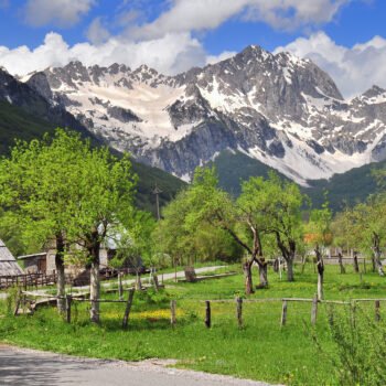
It is believed that the Celts named this family of giants. What the Celts were doing in one of the most beautiful parts of the Dinarides, Durmitor has not yet revealed to us. But it has never hidden its own splendor: to snow lovers, it proudly displays its magnificent winter simplicity, to mountaineers, explorers, and those yearning for silence, unusual landscapes and extraordinary ornaments, original immobile rocks and wondrous waters, plants that no one else has.
The largest valley in Durmitor is the Pošćenska Valley. It is about 8 km long and about two km wide.
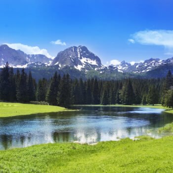
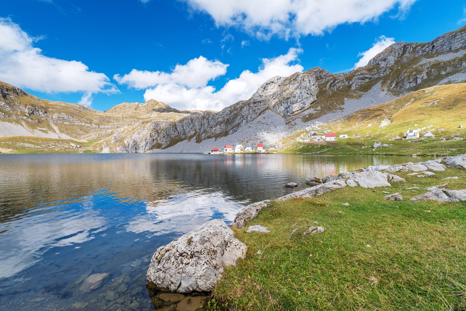
Durmitor also has a living glacier (Debeli Namet). Due to its limestone composition, it lacks surface water, but it has an abundance of underground water and numerous springs, even at great heights. At 2,000 meters is the Savina Voda spring.
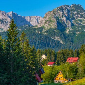
About ancient times in Durmitor, tumuli, a large number of stećak tombstones (“Greek and Roman cemeteries”) in necropolises in Novakovići and Bare Žugića speak. Then, 14 km from Žabljak, are the remains of the town of Pirlitor, probably from the 14th century. The monasteries of Dovolja and St. Archangel Michael on Tara were built in the 15th century, and the Dobrilovina monastery, an important cultural center, in the 17th century. Folk architecture, old watermills, and “savardaci” – circular huts with steep straw roofs – are also interesting.
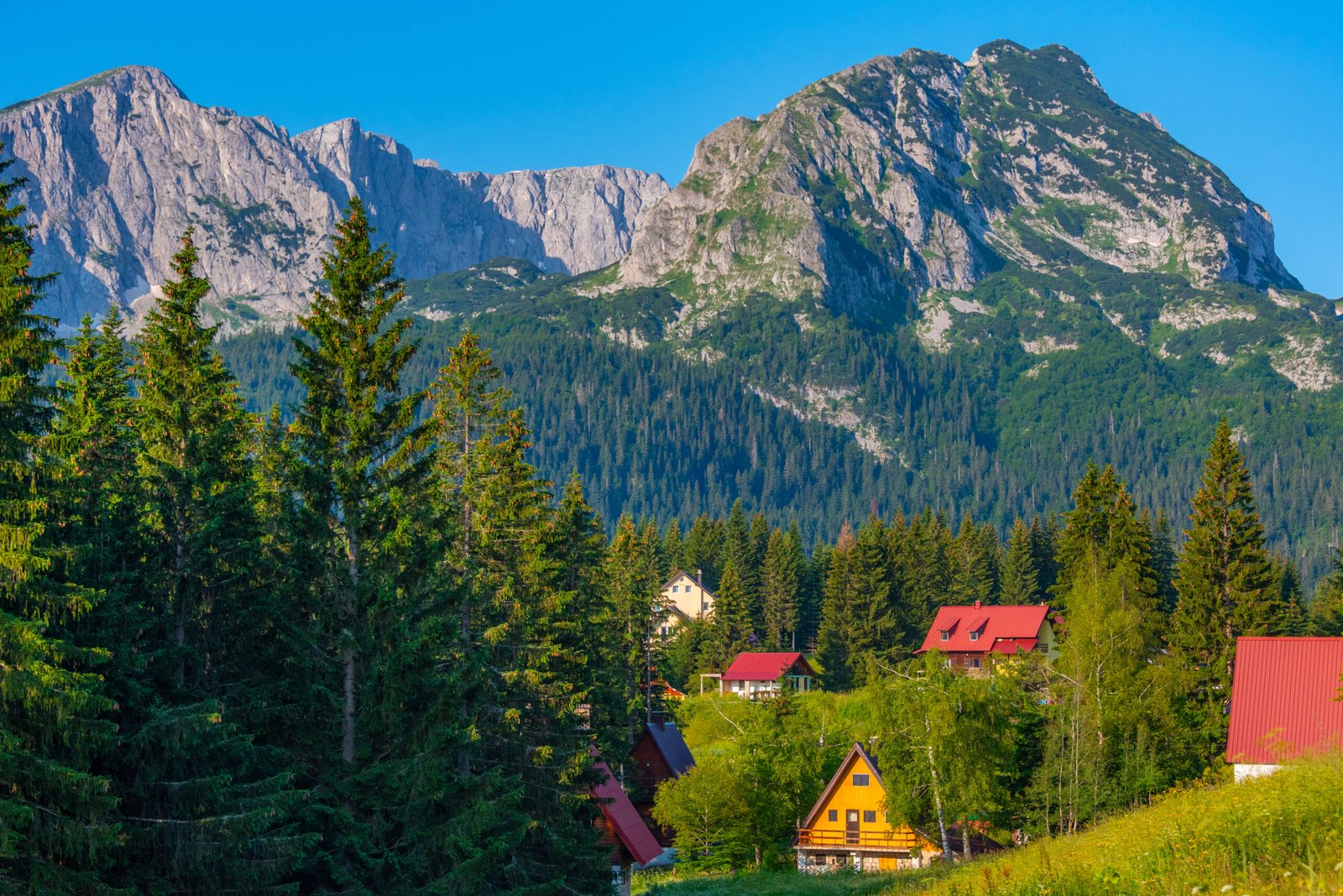
DURMITOR NATIONAL PARK
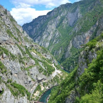
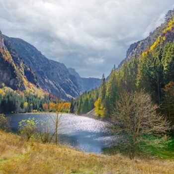
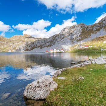
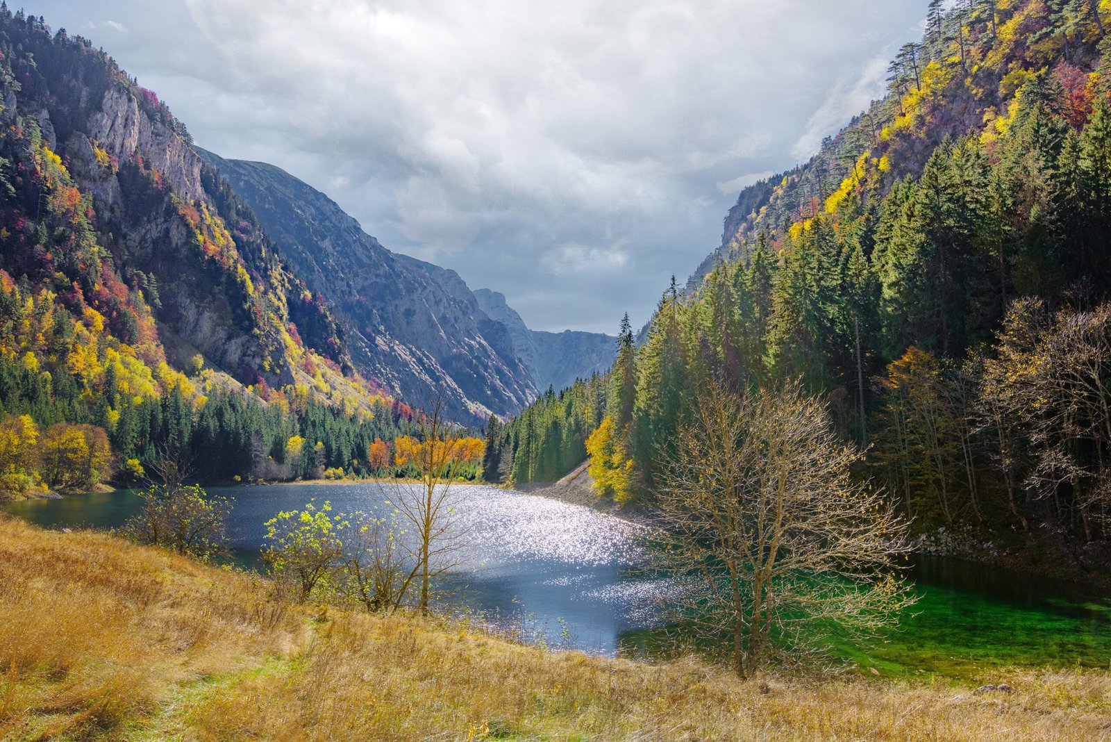
To protect this exceptional area, “Durmitor” National Park was established in Žabljak in 1952. The park covers an area of 36,857 hectares, within the municipalities of Žabljak, Pljevlja, Plužine, Šavnik, and Mojkovac. It includes the Durmitor massif, parts of the Jezera surfaces, the Sušica Canyon, the Tara Canyon from the mouth of Ravnjak to the border with Bosnia and Herzegovina (60 km), the canyon valleys of the Vaškovačka River and Draga, the source of Bukovica, Komarnica, Grabovica, and Zabojsko Lake.
The entire Durmitor area, with the largest part of the Tara Canyon, was inscribed on the World Heritage List in Paris in 1980. Special values of the National Park include the Tara Canyon, Crna Poda – a black pine forest, Crno Lake, a spruce and fir primeval forest near Mlincki Potok, the basin of the Škrčka Lakes and the Sušica Canyon, the Barno Lake biological reserve, and Zabojsko Lake. Within the national park, there are 186 caves and 118 pits.
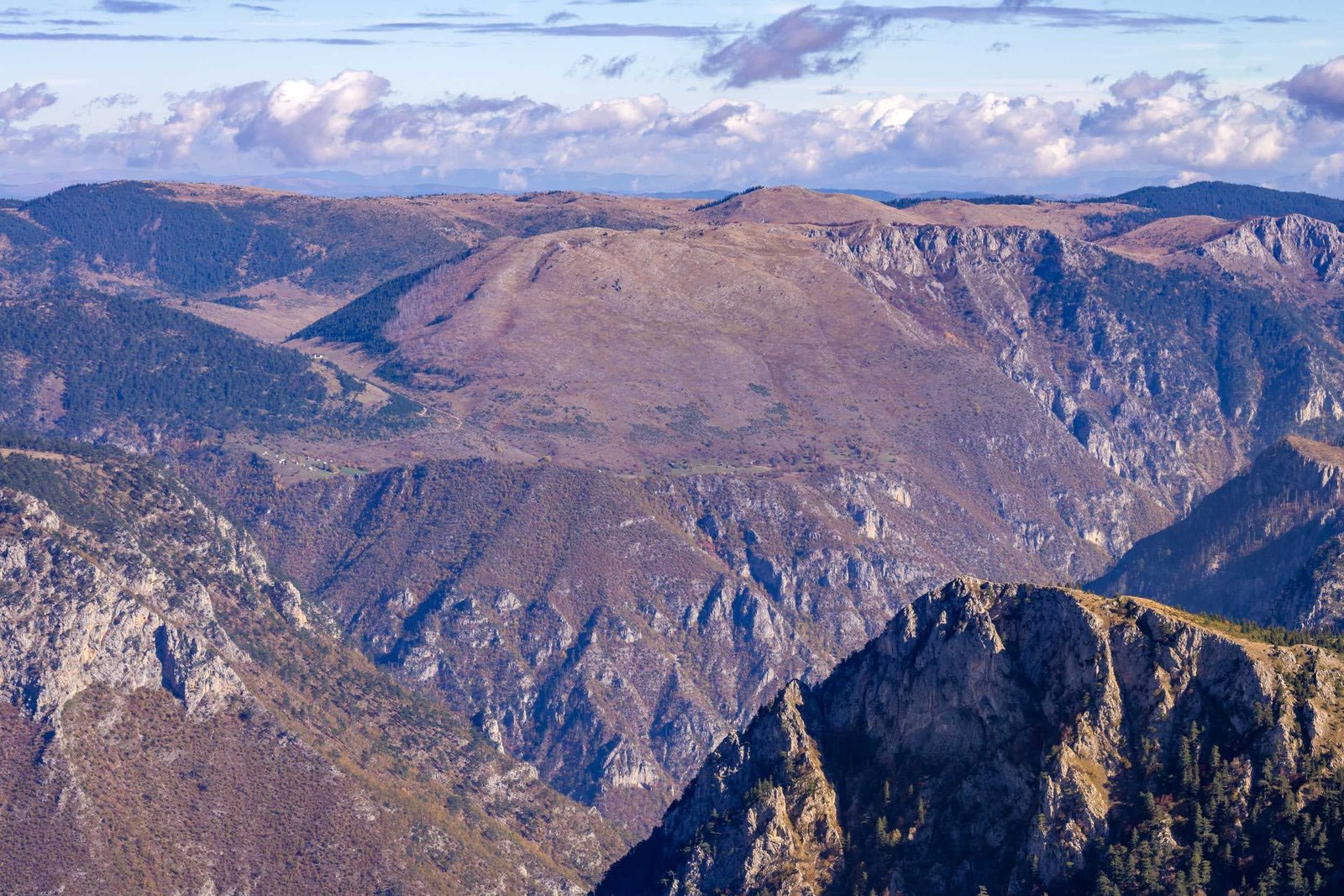
PIVSKA PLANINA
Pivska Planina is largely a high plateau, with an average altitude of 1450 m. Its natural borders are the canyons of Tara, Sušica, Piva, and Komarnica, and the Durmitor massif.
Surrounded by grandiose canyons, among the deepest and largest in the world, it is not very accessible. Therefore, it is always a bit lonely, and in winter often completely cut off from the world.
Pivska Planina extends in a northwest-southeast direction, about 40 kilometers long and about 12 km wide. The edge of the plateau is slightly higher than the central part and steeply descends into canyons, up to 1000 meters deep. On the plateau there are many shallow sinkholes, and besides Crkvičko Polje, the largest plain on Pivska Planina, there are numerous coves and valleys (Nedajno, Kneževići, Bojati, and others).
Through the middle of Pivska Planina stretches a series of elevations, of which the more important are: Badoševica (1851m), V. Buručkovac (2094m), Lojanik (1889m), Suvi Klek (2092m), Planinica (2004m), Milogora (1763 m) and Tršteno Brdo (1772m).
Water scarcity is the biggest problem. One can walk for miles across the mountain without encountering a spring, stream, or small river.
During the Middle Ages, when Herceg Stjepan ruled Piva and Herzegovina was being formed, this area was very lively. Stjepan’s traces have been preserved to this day, either through toponyms or through the remains of buildings he erected. Thus, in the village of Hercegova Strana, near Trsa, were his summer pastures, and at the confluence of the Piva and Tara rivers, there are still remains of Soko Grad, once his seat.
In the village of Trsa, there is the Church of Saint George, a legacy of King Nikola, built in 1889. The beauty of Pivska Planina, besides its fantastic viewpoints, is enhanced by wildflowers and the scent of pine. Of course, for all senses to enjoy, there is also Pivski kajmak (a type of cream cheese), as well as cheese, lamb, potatoes…
PIVA NATURE PARK
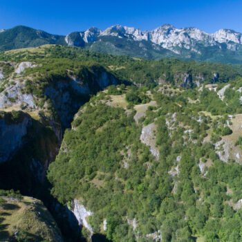
The “Piva” Nature Park is located in the far northwest of Montenegro, between the state border with Bosnia and Herzegovina and the border of “Durmitor” National Park.
It encompasses mountain plateaus with rich pastures and forests, deeply carved canyons of Tara, Piva, and Sušica, as well as lakes – Stabanjska and Trnovačko.
The park area has very diverse ecosystems and habitats. Approximately 1500 plant species have been registered, many of which are rare and endangered. Forests of white and black pine, beech and fir, maple, spruce, and ash are well preserved. Bears, wild boars, and deer live in them.
Rivers, especially Tara and Piva, are rich in brown trout, grayling, and huchen. Small newts feel safe in the natural lakes.
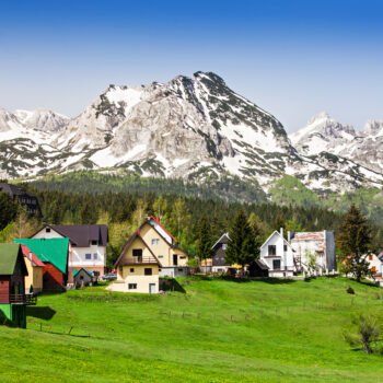
The area is completed by about twenty villages and numerous katuns (traditional summer settlements), which bear witness to the history and culture of Piva.
SINJAJEVINA
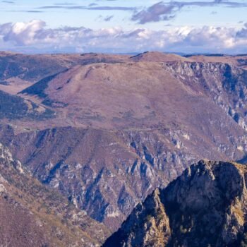
Sinjajevina (older, more authentic name Sinjavina) is the largest pasture in Montenegro, and also in the Balkans. It covers more than 60 square kilometers. It is bordered by the canyons of powerful mountain rivers. To the south, the Morača flows, while on its eastern and northern sides, this area is surrounded by the Tara. However, first and foremost, it may or may not be a mountain. Even geographers are divided. For some, it is a mountain plateau, with an average height of about 1,600 meters.
However defined, it is special. Without springs, without trees, it stirs and awakens melancholy and sadness, unrest and a chill, touching the subconscious. But with some loneliness and tenderness in the evening, it gains favor. Its gray-green beauty, seemingly petrified because Sinjajevina is all stone, merely covered with grass, is actually the beauty of a horse’s croup. A shimmering glow, a strength ready to transform into wings at any moment. A dragon. On Sinjajevina, you are on the back of a giant, enchanted dragon. It sleeps, tied by rivers, constrained by Tara, Morača, Tušinja, and Bukovica, and surely dreams. In summer, when snow still gleams white between the vertebrae of the terrible dragon, when sinkholes and pits are empty and pull downwards somewhere, when sheep sneak around puddles, it is very fresh here.
Thus, for stockbreeders, who were once almost all its inhabitants, it is a treasure. It was always precisely known which tribe had rights to which part. Sinjajevina extends in a southeast-northwest direction. It is on average 15 kilometers wide. Its length is 40 kilometers. Besides the pleasure of passing through or staying in a katun, it will also provide the fulfillment that comes from conquering its peaks, as there are several high ones. The highest is Jablanov Vrh, 2,203 m above sea level. It is followed by Veliki Pećarac 2,042m, Starac 2,022m, Korman 1,923 m above sea level.
The climate on Sinjajevina is very harsh. As an undulating plateau, Sinjajevina is a magnet for cold air and clouds. They say that when it’s clear everywhere else, the clouds leave Sinjajevina last.
The names of the lakes and their advanced stage of extinction (Zabojsko, Zminičko, Riblje, Vražje Jezero) suggest that even the lakes are enchanted, and have been for a long time.
The Church of Saint Basil of Ostrog in the Okrugljak katun also has great historical significance. It was built at the end of the 19th century and restored in 1992. It was erected with contributions from the Bjelopavlići in gratitude to King Nikola for gifting them a part of Sinjajevina for their merits during the liberation wars against the Turks.
After World War II, as villages emptied during rapid industrialization, so did the katuns. There were fewer and fewer sheep on Sinjajevina, fewer and fewer huts. It was also unknown to tourists. And then things started to change. Cyclists were the first to discover the beauty of its landscapes, which only at first glance seem monotonous. And in winter, snowshoeing expeditions are organized here. Sinjajevina attracts tourists, both in summer and winter, and so it should be.
PROŠĆENSKE MOUNTAINS
North of the right bank of the Tara, the gentle Prošćenske Planine stretch out, with about ten accessible peaks and extraordinary viewpoints.
The sides of the Prošćenske Planine facing the Tara River are very steep, almost vertical. But from their edges, a unique view opens up to the famous Tara Canyon, the deepest but also the most beautiful European canyon. This is followed by vast, gently undulating meadows (at about 1,400 meters of altitude), centuries-old coniferous forests, clear and cold springs and streams, sinkholes and valleys where the katuns of the Prošćenske shepherds are located.
Prošćenske Žari, Meki Do, the vast Stupsko Polje, Burenski Do, Barice, Ljeljeni Vrh, as the highest, with 1,856 meters – are part of the idyll of the Prošćenske Planine. Slightly lower peaks are Goveđa Glava (1656 m), Ledenice (1689 m), Sveviđe (1556 m), Zabrćka Glava (1752 m), Baltića Šiljak (1673 m).
One of the exceptional natural gems and tourist assets of the Prošćenske Planine is the almost completely unknown black pine primeval forest, Stupski Potok. It belongs to Durmitor National Park, and locals also call it “invisible,” and for good reason.
The Stupski Potok primeval forest, indeed, cannot be seen until you literally step on it. It is located in a hollow, covering an area of 25 hectares, in the Tara Rocks, just below the edge of the plateau, so it can only be seen from the ground from a kind of bird’s-eye view, and only if approached within a few meters! The true impression of this forest is only gained when one enters it.
North of Stupsko Polje extends the limestone depression of Crvena Lokva, with numerous sinkholes at its bottom. It is assumed that it was formed when the Tara River had a much higher level, while a small river flowed through Crvena Lokva. Over time, the Tara deepened its bed, and the small river flowing through the depression began to sink and eventually disappeared.
LUKAVICA
On the beautiful Lukavica, there are as many lakes as there are days in a year. This is how fairies counted, and more recent statistics say something similar.
In the distant past, the glacier left its marks on Lukavica, and you will be amazed by the various natural forms. Two lakes, Kapetanovo and Manito Jezero, were also formed due to the glacier.
Lukavica also entices with the impressive peaks of Veliki Žurim (2,036 m) and the three-headed Mali Žurim (1,984 m). Although there are not as many katuns as there once were, this area is so beautiful that hikers, cyclists, motorcyclists, and off-road adventure enthusiasts adore it. They say that one should visit Žurim at least once in a lifetime – in spring. That’s when the subtle whiteness of the snowdrop flower, also known as narcissus, rivals the lingering whiteness of the snow.
ALTITUDES
The numbers speak for themselves:
At 1,856 meters, Ljeljeni Vrh is the highest peak of the Prošćenske Planine. Ledenica is 1688m, Javorova Gora 1714m.
Among the highest peaks of Sinjajevina are Mramorje (1,852m), Veliki Starac (2,022m), Veliki Pećarac (2,041m), Jablanov Vrh (2,203m), Vranova Glava (2,215m), Torna (2,253m), Babin Zub (2,277m).
Pivska Planina has three mountain ranges, including: Bobotov Vrh (1,774 m), Vagan (1,776m), Trešteno Brdo (1,772m), Milogora (Veliki Ljeljenak, 1,768 m), Velika Orajevica (1,839m), Planinica (2,051m), Prečanska Strana (2,005m).
On Lukavica are the beautiful Veliki Žurim and Mali Žurim (2,036m, 1,984m).
The highest point of Durmitor is Bobotov Kuk: an immodest 2,523 m. But it is not alone in the clouds: there are as many as 60 peaks over 2,000 meters, and about twenty over 2,300 meters. The most famous are Šljeme (2,455 m), Đevojka (2,440m), Prutaš (2,393m), Savin Kuk (2,313m), Međed (2,280m), Šareni Pasovi (2,248m), Veliki Štuoc (2,104m)…